

Before coming to Arizona, I had never heard of Chiricahua. With so many big famous landmarks and parks like the Grand Canyon, it’s understandable that this out-of-the-way National Monument would be overlooked. But that’s a huge mistake! If you are visiting Tucson or road-tripping through the Southwest, Chiricahua is an amazing place to visit and not something you want to miss!
Personally, I would recommend doing this as a weekend trip and spending at least one night in the park, but it is possible to just visit for the day and do a short hike and a drive through the park. Really though, this is a decently big place, and the longer you have for a visit, the more you’ll get to see! This is one of my favorite NPS sites, and I will talk about it to anyone who’s willing to listen – and I’ll write about for anyone who doesn’t want to listen! Chiricahua is an amazing experience, and I personally think that everyone should visit. So, here’s my guide on how to visit the park and what I love about it!

General Guide
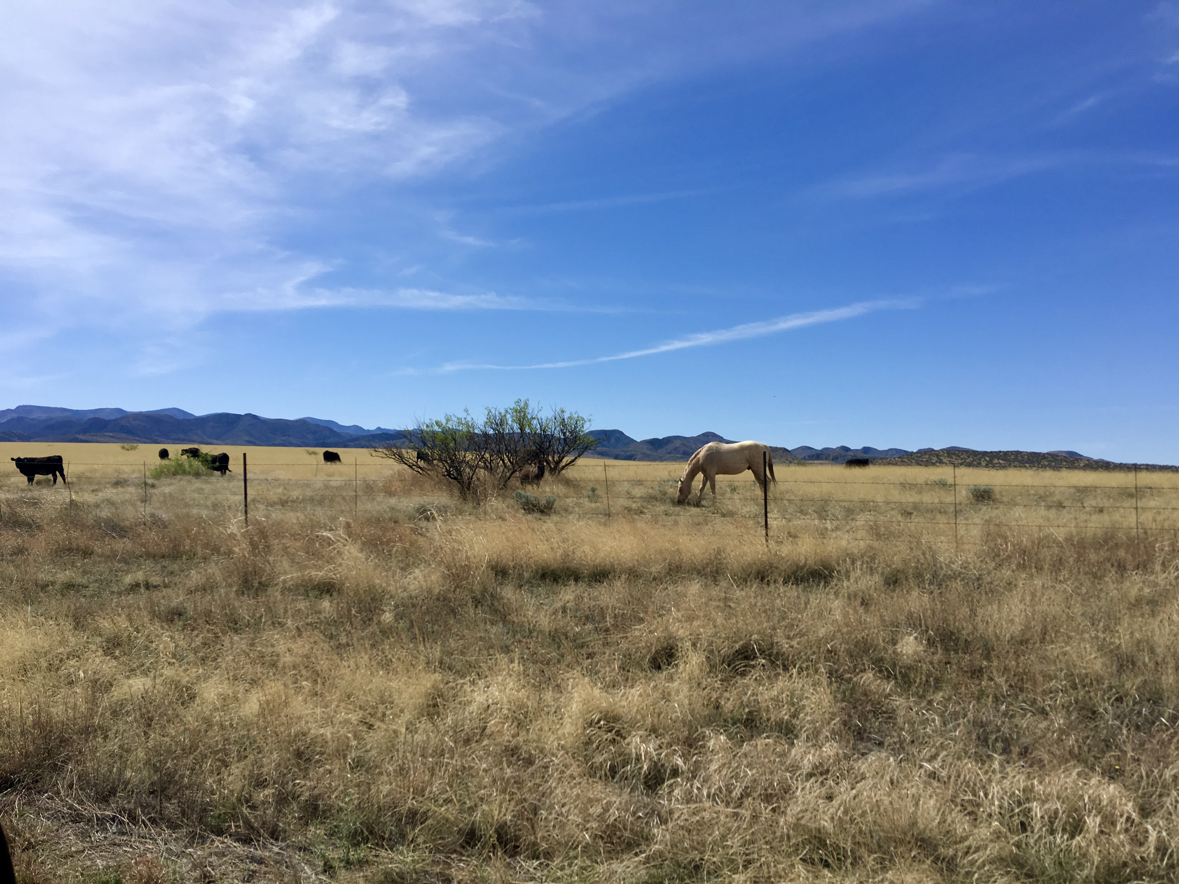
Chiricahua is amazing because not only do you really get away from the city, you also get to see a really unique Sky Island, and Sky Islands are very easily my favorite places in the world – or at least in Arizona. Essentially, Sky Islands are isolated mountains surrounded by lowlands that have very different environments. Though the term is now applied to places around the world that fit the definition, it originally referred to the mountains of Arizona and New Mexico specifically because the differences between the mountains and lowlands are so very different. The best example (in my opinion) is taking a drive up Mt. Lemmon in Tucson because the vegetation along the road changes rapidly from saguaros to ponderosa pines.
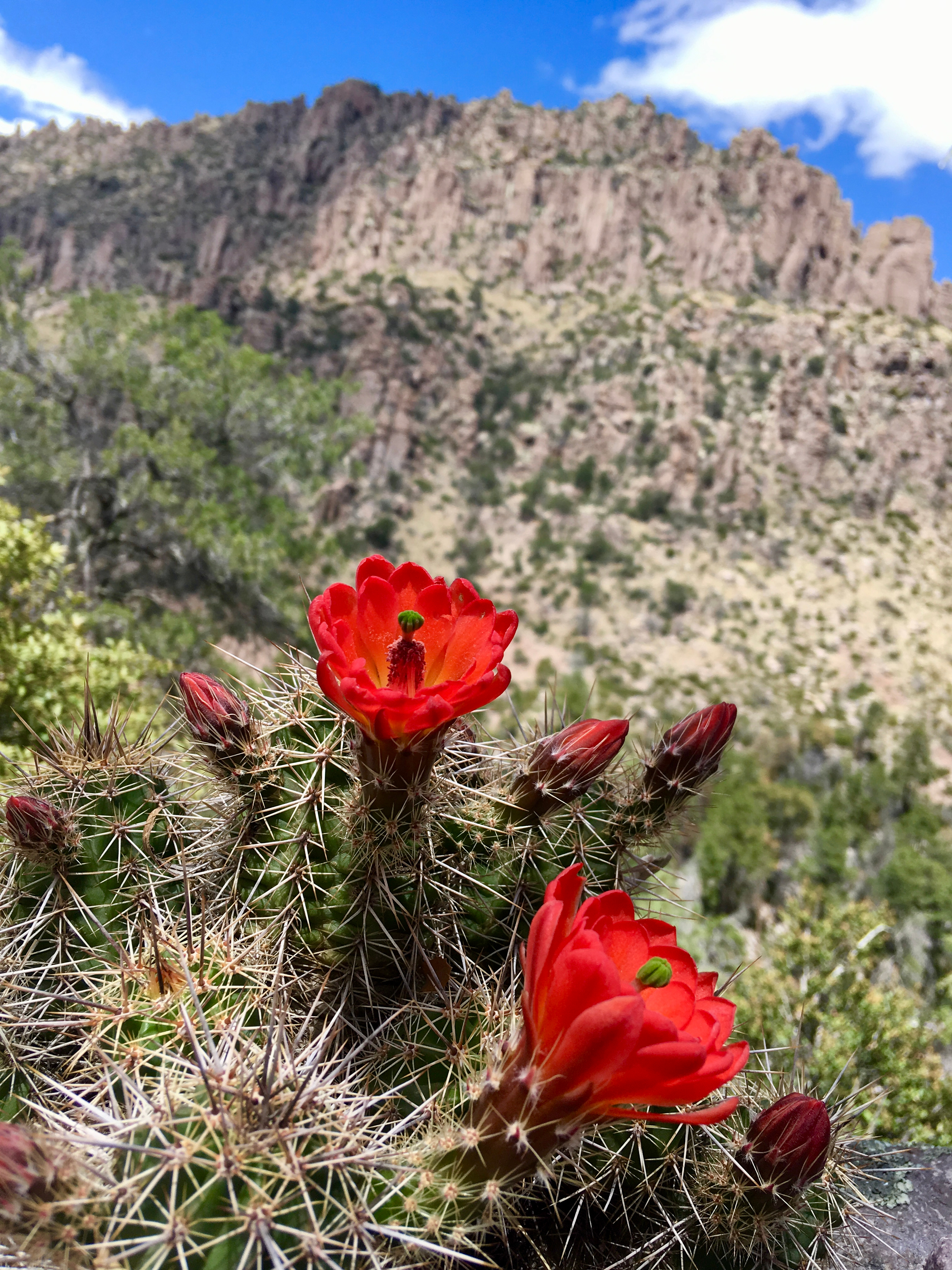
Though Chiricahua is an excellent Sky Island, the real draw here is its rock pillars (called hoodoos), some of which you can see in the above image. The simple explanation for how these formed is that an ancient volcanic eruption caused the rhyolite of the rock here to coalesce under the extreme temperatures. Weaker materials then eroded away and left behind these awesome hoodoos that you can hike through. Also, the elevation of Chiricahua at this particular location puts it at an amazing intersection for plants and wildlife – including coatimundis, which are so adorable but so hard to spot. Coatimundis (or just coatis) are actually native to South America, and this region of Southern Arizona is as far north as they will go.

Prior to 1861, this area was inhabited by the Chiricahua Apache whose nomadic lifestyle benefited from the Sky Island as they would traditionally spend winter in the plains and summer in the mountains. Anyone who has studied the history of the Southwest has heard of the Apache who fought against both Spanish and American settlers beginning in the early 1700s. Though the Apache and Spanish had largely achieved peace by the 1770s, this changed when Mexico gained its independence in 1821, and raids started again. American settlement in the Southwest, following the Gadsden Purchase and the Treaty of Guadalupe-Hidalgo (which gave the U.S. control of the region), led to the Apache Wars between the Apache and the U.S. military.
I won’t go into detail on the Apache Wars here, since it’s a long, complicated history, but this time was a huge part of the history of Chiricahua. Apache Chief Cochise was the leader of the Chiricahua Apache at this time, and he spent his life fighting for his people’s independence. According to the NPS page on the Apache Wars, Cochise “was the only one able to bring prolonged peace and freedom to his people, even if it did not last long after his death.” Following the death of Cochise, the Chiricahua reservation was closed and the Apache there were moved to the San Carlos Reservation. (The famous Geronimo continued Cochise’s fight for Apache independence in Southern Arizona until his surrender and imprisonment in 1886.) Ultimately, Chiricahua became a National Monument in 1924, and Fort Bowie (where American troops were based during the Apache Wars) was classified as a National Historic Site in 1972.
Today, on a drive out to Chiricahua, you will pass through the Dragoon Mountains where Cochise had his stronghold as well as by Fort Bowie. Also, if you look carefully while hiking at Chiricahua, you can spot Cochise Head (above). Once again, I have to quote the National Park Service who said it best that: “This peaceful landscape stands in stark contrast to the violence that once gripped this land.”
When to Go
Spring, Summer, or Fall – the weather will be cool at night whenever you go, and it will be hot in the day too. In the spring, you can see some great colors – the leaves here change color in the spring, and there are also flowers. Summer and fall also have good weather though, and since the main views are rocky, it’s a good year-round place to visit. The main thing to know is that the trails can get icy in the winter, and monsoon season at the end of summer means flash flooding. If you’re planning to camp, be advised that it does get pretty cold at night, which is why this is a good place to visit in the summer to escape some of that Arizona heat.
How Long to Stay
This is a really great place to go for a weekend out of Tucson. You’re basically in the middle of nowhere, but it’s only about a two-hour drive from the city. I think two days in the park is ideal, but if you’re going just for a day trip, you’ll need to factor in the 4 hours of driving to your planning. For that reason (especially in the summer), you’ll want to leave around sunrise or before to beat some of the heat and should plan to drive back during the afternoon when it gets really hot.
What to Bring
Chiricahua is not a national park with a lot of restaurants nearby, so I highly recommend packing a picnic lunch. If you’re camping, you’ll need to have food for all your meals. In driving from Tucson, Benson is the last place with a Target or Walmart, and this is where you should stop to check that you have everything you need. The nearest town to Chiricahua is Wilcox, which is pretty small, but should be able to provide any necessities if you really need something. But keep in mind that even this is 40 minutes out of the park and does not have a lot of restaurants.
Being in the desert, you obviously need water, especially if you plan to hike. Given how remote Chiricahua is, I highly suggest leaning into the Arizona trend of having a whole case of water in the trunk of your car just in case you need it. And bring more water than you need when hiking because there is no shade at all, and you will have regrets otherwise.
For camping, be sure you have everything you need, and consider a thermal sleeping bag because it gets very cold. And of course, the 10 Essentials are a good starting place in planning your packing.


What to Do
Though I really suggest spending two days in the park, and although that’s what I’ll mostly talk about since that’s how I’ve visited, I’m providing both a one-day itinerary and a two-day itinerary.
One Day at Chiricahua
- Leave Tucson around 5-6 am (or earlier, especially in the summer)
- Arrive at Chiricahua between 7-8 am
- Echo Canyon Trail
- Picnic Lunch – OR return to Tucson for the afternoon
- Silver Spur Meadow Trail AND/OR Sugarloaf Mountain Trail
- Return to Tucson in the late afternoon/evening
Two Days at Chiricahua
- Day 1
- Leave Tucson around 7 am
- Arrive at Chiricahua around 9 am
- Silver Spur Meadow Trail/Faraway Ranch Tour
- Picnic at the end of the trail
- Set up camp at Bonita Canyon Campground
- Afternoon to rest
- Sugarloaf Mountain Trail
- Start about 1.5 hours before sunset
- Watch sunset on the mountain
- Return to camp for dinner and bed
- Optional: Drive to the Sugarloaf parking lot for stargazing
- Day 2
- Breakfast and pack up camp
- Echo Canyon hike
- Picnic lunch
- Gift shop stop
- Optional: Visit to Fort Bowie
- Return to Tucson in the afternoon
- Eat a well-earned dinner in Tucson
From Tucson, it takes roughly two hours to reach Chiricahua. The last town, as I mentioned is Wilcox, and from there, it’s pretty hard to get lost. However, the turn off from AZ-186 to the smaller road that will take you to Chiricahua is very sudden, so you might pass it and have to double back. From here though, it’s a straight shot into the park. The drive into the park, takes you past some of the hoodoos, and it’s completely worth stopping along the road to take pictures of them.
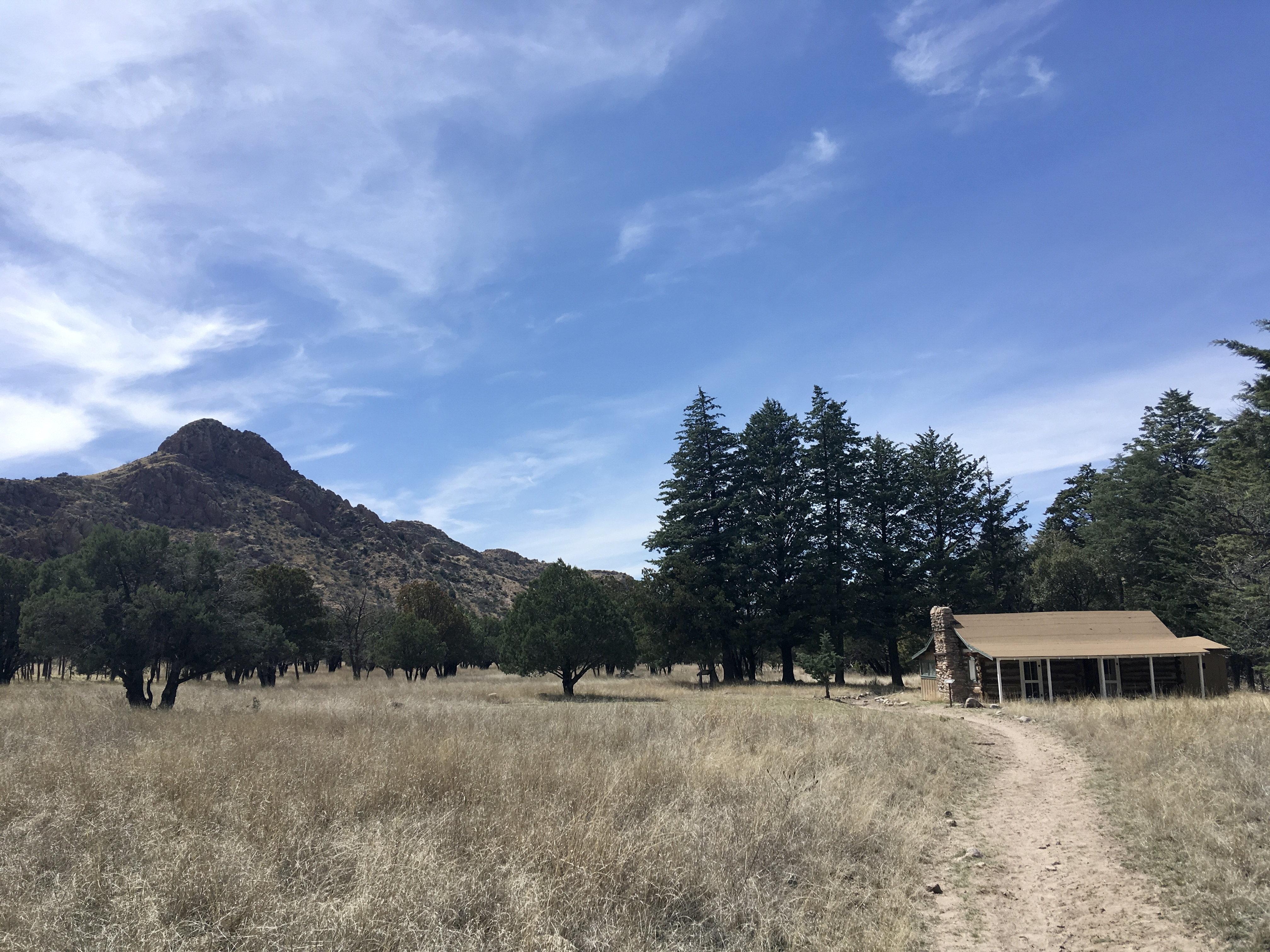
Once you reach the visitor center (if you’re doing an overnight trip or want to do multiple trails), check to see if there is a Faraway Ranch tour on the Silver Spur Meadow Trail. This is a good hike to start with in my opinion since it acquaints you with the area and is not at all strenuous. On weekends, the rangers do tours where they give you more information about the plants and animals in the park as well as the history of the first ranchers and later the CCC. It’s also with this tour that you’re able to tour the Faraway Ranch house, which is pretty cool – I would live there. This trail is about a mile and a half, and there’s a nice place for a picnic at the far end. Taking lunch with you and eating here before you head back is a great idea. NOTE: Due to COVID, Ranger tours are currently suspended and you cannot enter the Faraway Ranch house.
Once you hike back to the Visitor’s Center, it will probably be late enough to head to Bonita Canyon Campground and set up for the night (for a one-day trip, you would just go ahead to the Echo Canyon Trail if you added Faraway Ranch). Taking some time to decompress after setting up tents is pretty nice especially since the second hike of the day is more demanding. The campground here is a little expensive – about $20 a night – and you have to camp at the actual campground, which can get crowded, so book in advance.
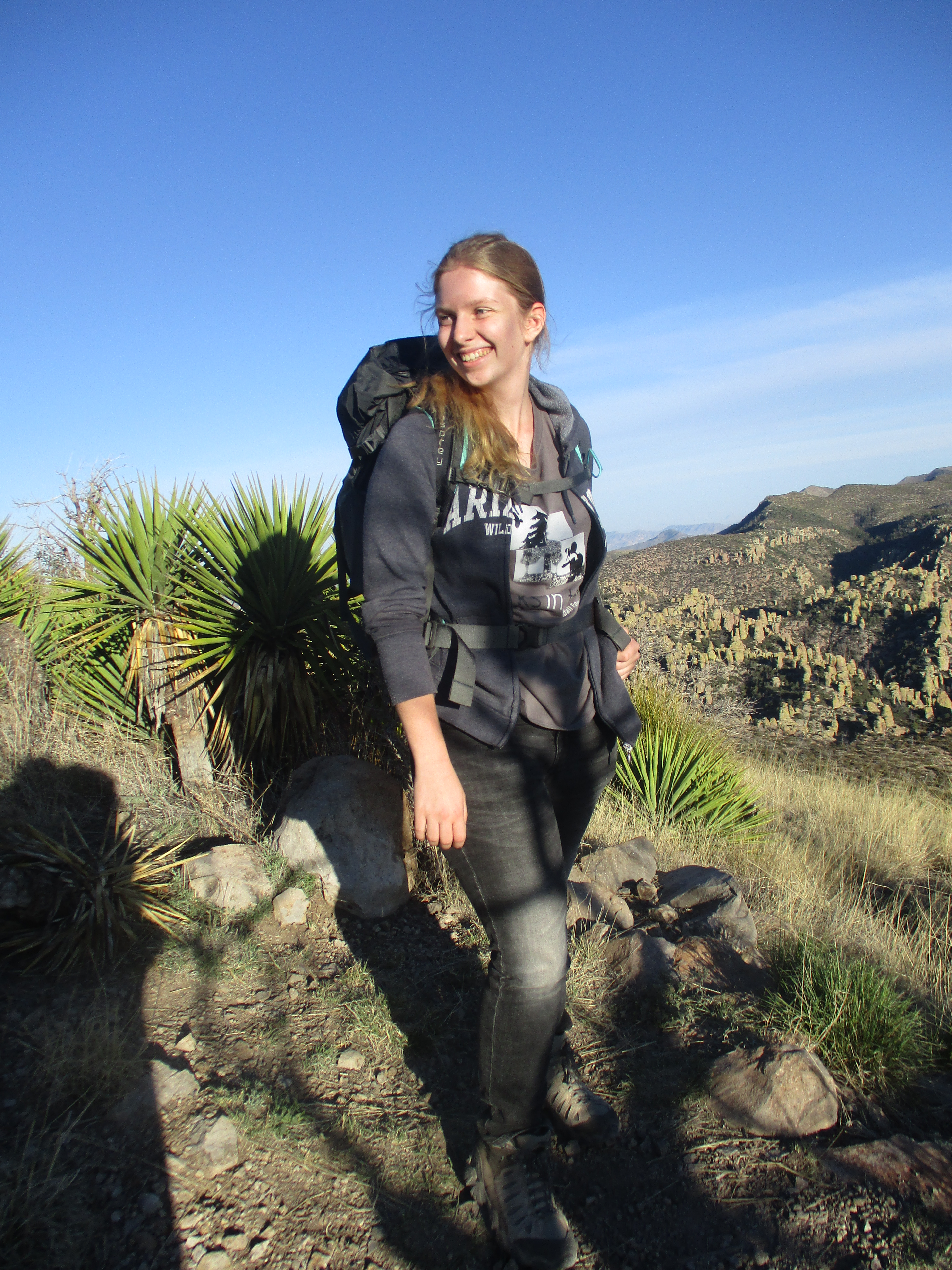
The second hike and my favorite is Sugarloaf Mountain. From the campground, it’s about a 15 minute drive up to the starting point for this hike. Check what time sunset is (they list it in the Visitor’s Center) and plan to start hiking about an hour and a half before that. The Sugarloaf trail is only 1.8 miles, but it’s steep. Even with a bunch of kids though, everyone made it to the top in under an hour – and that includes a few stops for water breaks. Pack some snacks to eat at the top, and wait for the sunset. You can get some pretty nice pictures up here!
Once the sun goes down, make sure you have headlamps and/or flashlights. The trail is not at all even, and though it’s easier going down, someone always gets hurt somehow. At this point, I would recommend going back to the campground for dinner then returning to the Sugarloaf parking lot a bit later in the evening to stargaze (and maybe see a meteor shower if you time your trip for that). Keep in mind that Chiricahua has high elevation, and from the time you hike Sugarloaf until the next morning, you will want a jacket, especially in the spring or fall. If you’re from Tucson or a similar climate, pack like you’re going to the Arctic; if you’re from somewhere cooler, a sweatshirt should be fine. Thermal sleeping bags are for everyone though.

In the morning, when you start is up to you. The best of Chiricahua is seen on a longer hike, and that’s what today is for. I will note here that in traveling with a group of kids, a lot of them did not enjoy the longer hike and a better option turned out to be hiking to the Grottos on the Echo Canyon Trail and turning around there. That said, for adults, I definitely recommend doing a longer trail on day two. So pack the car, pack a lunch, and drive to the Visitor’s Center. The best way to really see Chiricahua in my opinion is hiking one of these trails, but hiking back up is not great. Fortunately, the Visitor’s Center offers shuttles up to the Echo Canyon parking lot which is where the longer trails start. NOTE: The shuttle system is currently suspended due to COVID.
From here, I really loved taking the Echo Canyon Trail down to where it connects with the Rhyolite Trail, which leads back to the Visitor’s Center. This is a total of 4.2 miles, and it’s really not too hard, especially if you take water breaks. Don’t forget to stop by the Echo Canyon Grotto which is a super cool area that you can actually climb up and around in. It’s hard to get good pictures, but it’s fantastic and also a good shady spot to take a snack break. This trail is mostly downhill as well, and it’s well-traveled, so as long as you remember sunscreen, you’ll have a great time.
Also from the Echo Canyon parking lot, you can take the Ed Riggs Trail to the Mushroom Rock Trail to the Big Balanced Rock Trail (it’s confusing; grab a map at the Visitor’s Center though, and you’ll be fine). This takes you to Pinnacle Balanced Rock, which is a central part of the park. Since I have only been to Chiricahua with kids, I haven’t been to this section, but with the most famous rock in the park, it’s somewhere I want to go. From the parking lot to the Visitor’s Center, this is a total of about 7.2 miles. If both of these sound a little long, there’s also a loop comprised of Echo Canyon, Hailstone, and Ed Riggs that comes to about three miles and gets you back to the parking lot, meaning you wouldn’t need the shuttle service.
Hiking up Sugarloaf 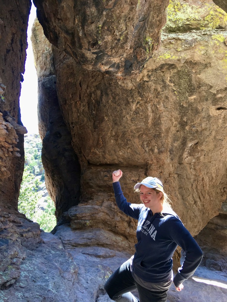
Look! I’m earthbending!
Final Notes
Chiricahua is a fantastic place that I love visiting, and even if you don’t have the time for a long hike, at the very least, it’s worth going along Bonita Canyon Drive to see some of the hoodoos that make this place so amazing! Chiricahua is probably one of my favorite places in Arizona, and I’m so glad that I have been able to visit multiple times. It’s such a fun, beautiful place to explore and like nowhere else I’ve ever been!

Sounds fun.
On Sun, Apr 7, 2019 at 2:01 PM Wonderlust Writings wrote:
> kendyl112 posted: “Like last year, I did another Parks in Focus trip to > Chiricahua National Monument last weekend. This isn’t the most famous > landmark in Arizona by a long shot, and it’s definitely out of the way, but > it’s honestly phenomenal, especially as a weekend trip ” >
LikeLike